Success of NVS-03: Why India Needs to Rethink Its Satellite Navigation Strategy
- November 02, 2026 |
- Issue Brief
NavIC, formerly known as the Indian Regional Navigation Satellite System (IRNSS), has had several major failures. This programme stood out as one of the most troublesome projects ISRO has undertaken in recent times. The system, which has significant strategic utility, was not available during Operation Sindoor (6–7 May 2025). More importantly, during this conflict, India found it evident that China was providing military-grade navigational signals to Pakistan using its BeiDou constellation.
The IRNSS project began as an independent regional satellite-based navigation system to provide accurate Position, Navigation and Timing (PNT) services over India and the surrounding region. Its primary service area extends approximately 1,500 kms beyond India’s geographical boundaries, while its extended service area covers a larger region between 30° South and 50° North latitudes and 30° East and 130° East longitudes. The system provides two types of services: the Standard Positioning Service (SPS), available to all civilian and commercial users, and the Restricted Service (RS), an encrypted service intended for authorised users, including strategic and defence agencies.
IRNSS provides SPS and RS to the users on dual frequencies in L5 and S band. The system has positioning accuracy better than 20 metres in its primary service area. It has applications in terrestrial, aerial and maritime navigation; disaster management; vehicle tracking; fleet management; mobile-phone integration; precise timing; mapping; geodetic data collection; and navigation assistance for drivers, hikers and travellers.[2] India needed such a system to reduce its dependence on foreign navigation constellations like GPS (US), GLONASS (Russian system), and Galileo (the EU constellation).
India is developing its own navigation system for both civilian and strategic uses. ISRO completed the deployment of the original seven-satellite IRNSS constellation on 28 April 2016. The constellation was designed with seven satellites: three in Geostationary Earth Orbit (GEO) and four in inclined Geosynchronous Earth Orbit (GSO). However, following technical problems with the atomic clocks aboard IRNSS-1A, a replacement satellite was launched on 12 April 2018. Subsequently, the system became fully functional for PNT services from April 2018.
Table 1. Launch history of the IRNSS/NavIC Constellation (First Generation)
| Satellite | Launch date | Remarks |
| IRNSS-1A | 01 July 2013 | Atomic clock failed |
| IRNSS-1B | 04 April 2014 | |
| IRNSS-1C | 16 October 2014 | Atomic clock failed |
| IRNSS-1D | 28 March 2015 | |
| IRNSS-1E | 20 January 2016 | Atomic clock failed |
| IRNSS-1F | 10 March 2016 | Atomic clock failed |
| IRNSS-1G | 28 April 2016 | Atomic clock failed |
| IRNSS-1H | 31 August 2017 | unsuccessful |
| IRNSS-1l | 12 April 2018 |
Source: “Navigational Satellites”, Master Control FacIndia, Indian Space Research Organisation, Department of Space, Government of India.
The operational capability of this constellation was affected mainly by repeated failures of the rubidium atomic clocks installed aboard its first-generation satellites. These clocks are essential because they provide the highly precise time references needed to determine users’ positions. These problems occurred with satellites IRNSS-1A, IRNSS-1C, IRNSS-1E and IRNSS-1G. In the case of IRNSS-1F, the atomic clock apparently stopped functioning on 13 March 2026, after the satellite had completed its designed 10-year mission life. It is important to note that an atomic clock failure does not make the satellite useless, as it can continue to function for various societal applications, including one-way broadcast messaging services.[3]
These failures pushed ISRO to replace ageing satellites and improve the reliability of onboard timing systems. Learning from the experience of the NavIC 1.0, ISRO is now developing the second-generation navigational system. Today, ISRO has indigenously developed a rubidium atomic clock. The Space Applications Centre, Ahmedabad, developed this space-qualified rubidium atomic clock. For the second-generation NVS series, ISRO launched NVS-01 in May 2023, with improved navigation technology and an indigenous rubidium atomic clock.
ISRO achieved a significant milestone on 29 January 2025, completing its 100th launch from the Satish Dhawan Space Centre, Sriharikota, with the 17th GSLV flight. The mission successfully placed the NVS-02 navigation satellite into its designated Geosynchronous Transfer Orbit (GTO). However, the subsequent orbit-raising operations encountered a technical setback. As a result, despite the successful launch, NVS-02 is not in its designated operational orbit.[4]
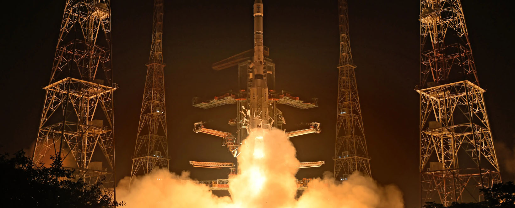
NVS-03, launched on 30 October 2026, is the third satellite in ISRO’s second-generation NavIC constellation. This constellation is expected to have five satellites. ISRO initiated the IRNSS programme nearly 15 years ago. Since then, navigation technologies have evolved considerably. Today, NVS-03 carries navigation payloads operating in three frequency bands: L1, L5 and S. The introduction of the L1 signal, alongside the existing L5 and S-band signals, is an important technological enhancement.[5]
This improves the system’s compatibility with other global navigation systems and facilitates its integration into a wider range of civilian and commercial receivers. The availability of multiple frequency bands also provides greater flexibility in receiver design. Manufacturers can now develop devices suited to different applications and operating conditions. Given this, future navigational services are expected to improve significantly. In the near future, NVS-04 and NVS-05, the fourth and fifth satellites for NavIC 2.0, will be launched. They are expected to offer enhanced navigation capabilities and are likely to carry the L1 signal alongside L5 and S.
Since the NVS-02 mission has failed and there is no public reference to a possible replacement for this satellite, India’s NavIC 2.0 could eventually have only four satellites. Based on experience in designing and developing a navigation network, India may be cautious about developing a second-generation system. India’s current approach suggests a preference for establishing an independent regional navigation capability before planning the more expensive task of developing a global navigational constellation, say with 30 satellites.
Broadly, India’s current approach looks justifiable. However, the question is whether India should continue with this nearly two-decade-old strategic thinking, especially as the global strategic landscape has changed significantly. Some recent conflicts have demonstrated China’s willingness and capability to extend navigation, satellite imagery and other space-based intelligence capabilities to countries such as Pakistan and Iran. China uses its space expertise as an instrument of geopolitical and military influence. Against this backdrop, India needs to look beyond the immediate objective of restoring its regional navigation system. India’s NavIC 2.0 proposal appears to be a means of meeting immediate needs. However, this is the time for India to consider developing a wider and eventually global PNT capability. India cannot aim to become a major space power with very limited investments in space-based navigational systems. This is not to argue that India needs to immediately commit resources to replicate systems like GPS, Galileo or BeiDou. However, India certainly needs to articulate a clear long-term ambition for a constellation with a global footprint. To do this, India needs to establish a well-defined technological roadmap for space-based navigation immediately.
Views expressed are of the author and do not necessarily reflect the views of the Manohar Parrikar IDSA or of the Government of India.
[1] “Parliament Question: Operational Status of Navic Constellation”, Press Information Bureau, Department of Space, Government of India, 29 July 2026.
[2] “IRNSS Programme”, Indian Space Research Organisation, Department of Space, Government of India; “IRNSS – Indian Regional Navigation Satellite System”, U R Rao Satellite Centre, Indian Space Research Organisation, Department of Space, Government of India.
[3] Jacob Koshy, “Failure of Atomic Clock Cripples ISRO’s NavIC System”, The Hindu, 15 March 2026; “RNSS-1F Successfully Completed Its Mission Life of 10 Years”, Indian Space Research Organisation, Department of Space, Government of India, 13 March 2026.
[4] “GSLV-F12/NVS-01 Mission”, Indian Space Research Organisation, Department of Space, Government of India; “GSLV-F15 / NVS-02 Mission”, Indian Space Research Organisation, Department of Space, Government of India.
[5] “GSLV-F18/NVS-03 Mission”, Press Information Bureau, Government of India, 1 November 2026.